Written By Jason Slade
Photography by Jason Slade Photography
Trip Leaders
Jason & Nicki Slade, Toyota Landcruiser 105 series
Trip Participants
Ian & Helen Harrison, Holden Colorado
Anne Dixon, Holden Rodeo
Brad Harrison, Holden Rodeo
Saturday
We all met up on a wintery raining Saturday morning on Davies Rd a little after 0800. Once we had all signed on we set off at 0830 for Warriedar Station via the old Rothsay Road seeing some of the local history along the way. We made good time and after a brief stop in Mingenew we carried on down the road to Enanty Barn which was our planned smoko stop. Enanty Barn is thought to have been built in the late 1800’s from local stone and bush timber. The shepherd’s rooms to the rear seem to support the theory that the sheep were annually shepherded from far afield to be brought home full of fleece to be sheared hence the three sheep outlets in the front of the barn. The barn was later used to sell fodder to the passing public (all traffic at the time used horses). The barn provided the cover we required to make coffee and have a bite to eat. Once replenished we were on the road again; travelling through Morawa and onto Perenjori where we had an extended fuelling stop. By now it was looking up as the rain seemed to be behind us.
Once all vehicles were refuelled we cleared Perenjori and made our way to the old Rothsay Rd which is now a 4wd only track that branches off what is essentially the new Rothsay Rd. The scrub had experienced a fair bit of regrowth since last we had driven it with the track narrow in places. The old road that used to link the township of Perenjori with Rothsay winds its way eastward through mainly eucalypt woodland, but broken up by the occasional mulga. Our first stop along the track was the Damperwah Experimental State Farm ruins. The Damperwah Research Station was established in 1929 by the Department of Agriculture to experiment with growing different strains of wheat and was soon recognised as the advisory centre for the dry regions of the wheatbelt where new farms were being successfully developed in marginal rainfall regions. The farm is situated on 10,600 acres 29 miles east of Perenjori and was officially opened on the 15th October 1929 though there had been preliminary trials conducted in 1928. Annual field days were held at the farm for which the local school children were given a day off. The Damperwah state farm closed c1940 and today you can see the ruins of three houses and their outhouses along with a literal forest of Century plants.
Having had a bite of lunch at the farm we get on the track again briefly before crossing Karara Rd and passing through the Vermin Proof Fence. Not too much further we get back off the track and stop to have a look around an Old Sandalwood Cutter’s Hut that still stands (just). By now the rain had started to return and by the time we reached our next stop at the John Forrest Lookout in the Damperwah Hills it was getting heavier. The tracks too were getting really slippery, a testament to which is yours truly taking an exit stage left off the track into the scrub. Nevertheless three of us braved the inclement conditions and climbed to the summit to take in….well not much really, what with the rain and all, visibility was cut right down. Still got a fairly good view of the landscape that lay before us though.
John Forrest Lookout is named after the explorer Sir John Forrest who during an 1897 expedition established his survey mark on top the hill that today bears his name. The lookout forms part of the Damperwah Hills which Forrest discovered and named during his 1869 search for explorer Ludwig Liechhardt. The search failed to find Ludwig but Forrest did report that his compass had been affected by the minerals in the ground and he suggested to the government for geologists to be sent out and examine the area. Quite fitting considering the discovery of gold and iron ore nearby.
After leaving the lookout we made our way into Rothsay and pull up at the old cemetery. Rothsay is an old gold mining town that was set up in around 1896 after George Woodley became the first man to strike gold in the Perenjori District in 1894. At the time the town had about 300 residents. Following Woodley’s find most of the area was pegged and by 1897 many of the valuable claims had been acquired by the Glasgow Syndicate. A company with a capital of 250,000 pounds was formed and its first operations led to the discovery of a gold seam approximately 200 feet long. The gold; once extracted, was sent to Yalgoo for treatment and then transported to Perth. However, the presence of copper in much of the ore caused difficulties in extraction and the mine was shut down in 1902. In 1915 an option was taken out by Berwick, Moreing and Co, who dewatered and sampled the mine but relinquished the option in July 1915. In 1918 is was acquired by the West Australia Development Syndicate who; over the next two years, sampled and investigated the metallurgical problems. The mine got a second lease of life in the 1930s when a company financed by mining entrepreneur Claude de Bemales reopened the mine in 1935. It operated productively for several years though water in the shaft caused problems and it was forced to close in 1939. Today the main pit and mine area are still closed off to the public due to active mining leases on the site.
In the cemetery it is believed there are a total of five graves, of which only two are marked. They are as follows: R.E.R. Esbenson, child; W. McLoughlin, male; J.D. Mason, male 68 who fell down a shaft; C. Purchase, child and Alfred Chopin who passed in 1898 and whose large marble headstone still stands today. The town itself suffered a setback in 1902 however in 1935, when the mining entrepreneur Claude de Bamales reopened the mine it experienced a second lease of life. A new 45 mile road was put in between Perenjori and Rothsay and townsite lots were released for sale in January 1935. Residents formed the Rothsay Progress Association and had tennis, football and cricket teams for their entertainment. The town included numerous houses, a school, post office, stores, boarding houses, tennis courts and a recreational ground. When the mine closed again in 1939, the town’s population slowly declined with the buildings falling into ruin. Rothsay now only has the odd stone wall and the concrete pads of bygone buildings as a reminder of what this town once was.
With the rain still coming down we departed Rothsay and continued east eventually joining up with the Warriedar-Coppermine Rd. We continued along the Warriedar-Coppermine Rd passing by Government Well, which was constructed sometime around 1825; and soon looming up ahead of us was the cloud shrouded distinct shape of Warriedar Hill. Not too far from here we turned south onto the Warriedar Rd for short run to the station. Upon crossing the airstrip we could see our first option for camp was taken with a caravan parked up at the stables.
Once across the creek we could see that in fact the entire homestead precinct was chocka-blok with campers. As it turns out the Amalgamated Prospectors & Leaseholders Association had also decided the long weekend would be good to travel to Warriedar Station. With no undercover options available to us, we decided to make camp out the back in the scrub. With the rain tumbling down we circled the wagons and in a flurry of tarps we had camp setup and reasonably dry. Ian did a head count and came back with 27 individual parties camped around the homestead. We decided that maybe the next day’s activities may be put on the backburner due to the wet track conditions but would assess in the morning. We all climbed into bed that night with the rain finally abated.
Sunday
We awoke to a wet, overcast morning. The rain had started up again earlier and was looking like setting in for the day. I did offer to put on a rain dance to try and appease the gods and have it stop but the thought of me in a grass skirt kind of put this idea to bed. We discussed the track situation again and came to the decision that it would be best to leave the exploring for another, drier, time and to head for the highway in case the rains intensified and we found ourselves stuck because of closed roads. Adding weight to this decision was the fact Anne would not be able to spend another night folded into the front seat of her vehicle like an economy passenger on a dodgy budget airline.
After breakfast, in between showers, we broke camp and made our up to the homestead where we had a wander about and a look around. From here we departed Warriedar Station and headed for the Great Northern Hwy passing through many floodways that were filling up fast.
Once out on the highway, Ian suggested we stop in at Ninghan Station for some smoko and also a chance for him to change his strides as by now they resembled the land over which we were travelling; wet and muddy. On arrival into Ninghan and speaking to the manager we were informed smoko was going to cost us $3 each. After handing over our hard earned we had smoko in the rain, used the loos and got back on the road again.
After stopping again briefly in Perenjori to use the facilities and to take some photos of the sorry state of our convoy, we carried on to Morawa for some lunch. Once back on the road and closing in on Mingenew, Ian again gets on the radio and suggests a side trip into Coalseam (thankyou Ian for managing to salvage something from the weekend). So we turn off and duck across to Coalseam where we take in the sights, everything lush and green; the wildflowers are going to be spectacular again this year. It is from here we travel back to Geraldton with a brief stop at the wind farm to sign off before making our way individually home.
 Wedge Island Overnighter – 21st Jan 2017 to 22nd Jan 2017


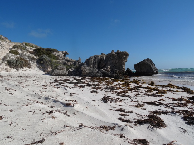
 2 cars, 5 people and a dog left Geraldton at 9.30, on a multi cultural adventure, 2 Pommes, a German, an Italian visitor and just the one Australian representative. (Ruth, Mathias, Anne, Mark and Serena) We drove to Port Gregory to pick up an ice cream before stopping at Pink Lake which was putting an a magnificent Pink display for our Italian visitor, a bit of a Wikipedia briefing about the lake was shared..


Recent Comments